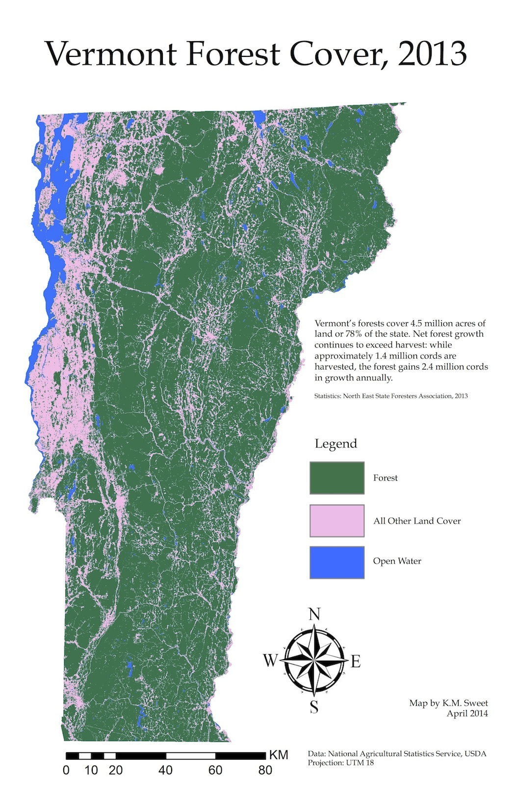
Vermont Forest Cover, 2013
Dublin Core
Title
Vermont Forest Cover, 2013
Subject
Forests
Description
This map displays contemporary Vermont Forest Cover using 2013 CropScape Cropland Data Layers.
Vermont’s forests cover 4.5 million acres of land or 78% of the state. Net forest growth continues to exceed harvest: while approximately 1.4 million cords are harvested, the forest gains 2.4 million cords in growth annually.
Statistics: North East State Foresters Association, 2013
Vermont’s forests cover 4.5 million acres of land or 78% of the state. Net forest growth continues to exceed harvest: while approximately 1.4 million cords are harvested, the forest gains 2.4 million cords in growth annually.
Statistics: North East State Foresters Association, 2013
Creator
Kristina M. Sweet
Source
Map designed by K.M. Sweet with 2013 data from CropScape, National Agricultural Statistics Service, United States Department of Agriculture and statistics from "The Economic Importance of Vermont's Forest-Based Economy 2013," North East State Foresters Association.
Publisher
FS 350: Food Systems Immersion (Food Systems Applications), 2014.
Date
[2013]
Relation
Format
JPG
Identifier
fsaseminar_307
Coverage
Vermont; 2013

