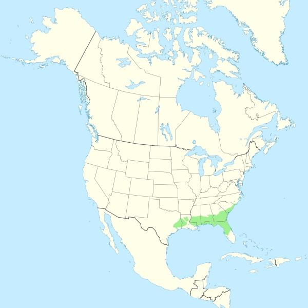
Magnolia grandiflora range map
Dublin Core
Title
Magnolia grandiflora range map
Description
Range map of southern magnolia (Magnolia grandiflora)
Creator
Halava
Publisher
Self-published work
Date
2011-08-14
Contributor
Rose Thackeray
Rights
Creative Commons Attribution-Share Alike 3.0 Unreported
Type
Still Image
Still Image Item Type Metadata
Original Format
Map
Physical Dimensions
2,000 x 2,000 pixels
About the Original Item
- Date Added
- November 3, 2014
- Collection
- Trees
- Item Type
- Still Image
- Citation
- Halava, “Magnolia grandiflora range map,” Omeka@CTL, accessed December 18, 2025, http://libraryexhibits.uvm.edu/omeka/items/show/2057.
- Associated Files

